Map Tab
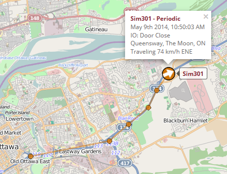
The Real-time Map tab shows the latest position of every radio. The icons on the map are color coded based on fleet and an arrow points in the direction of travel. Clicking the icon will bring up information about the GPS report. Clicking the label with the radio’s name will bring up a menu for the radio.
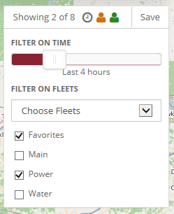
Map Filter
In large systems, the map can get cluttered with too many radios. The map filter will reduce the number of radios shown on the map based on how recently we received a GPS update for the radio and which fleet the radio belongs to. Clicking the "Save" button will update the map filter. Reducing the number of radios displayed on the map may also improve performance.
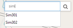
Search
The search bar on the map can be used to find an existing radio, Point of Interest or geofence. Otherwise, it can be used to lookup an a street address and find it on the map.
Following a Radio
A radio can be followed on the map by selecting "Follow on map" from a radio menu. When an update is received for the followed radio, it will be automatically re-centered on the map. Clicking the "cancel" button will stop following the radio.
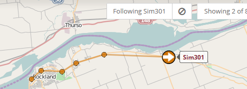
Breadcrumbs
The map can show a breadcrumb trail of the route the radio has taken. The application settings specify the maximum number of breadcrumb points shown for each radio, and when the breadcrumb points expire and disappear from the map - this makes it easy to quickly see which radios are currently moving about. If many radios are shown on the map at the same time (e.g. 100+), then performance can be improved by reducing or eliminating the number breadcrumbs.
Geosearch
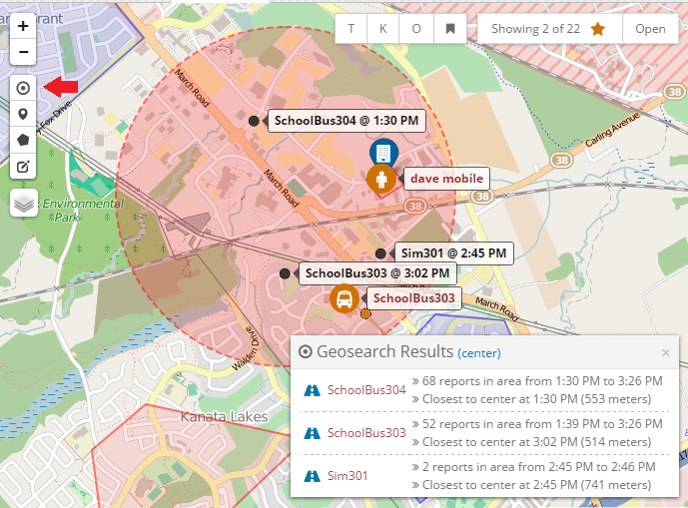
The Geosearch tool allows you to search for all radios that were in an area. After clicking the Geosearch button on the left hand panel, you can click and drag to draw a circle on the map and provide a time frame. The server will return a list of radios that were in the area during that period of time. Clicking on the "road" icon next to the radio will do a Route Replay for the radio during that time frame.
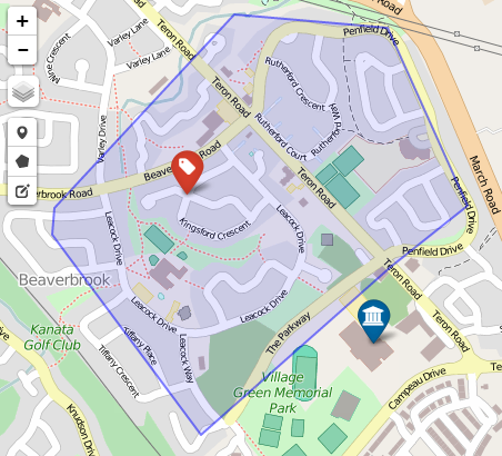
Points of Interest and Geofences
Points of Interests and Geofences can added and modified using the draw controls in the top left corner. A Point of Interest will place a marker on the map with a customizable colour and icon. Once a geofence is added, the server will check to see when a radio has entered or exited a geofence and create a Geofence Alert if necessary. A user must be given permission to manage the Points of Interest or Geofences on the system.